


POLK TWP Voting District, Monroe County, Pennsylvania
About
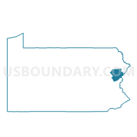
Outline

Summary
| Unique Area Identifier | 661237 |
| Name | POLK TWP Voting District |
| County | Monroe County |
| State | Pennsylvania |
| Area (square miles) | 31.18 |
| Land Area (square miles) | 30.79 |
| Water Area (square miles) | 0.39 |
| % of Land Area | 98.75 |
| % of Water Area | 1.25 |
| Latitude of the Internal Point | 40.92718370 |
| Longtitude of the Internal Point | -75.50185520 |
Maps


Graphs
Select a template below for downloading or customizing gragh for POLK TWP Voting District, Monroe County, Pennsylvania


Neighbors
Neighoring Voting District (by Name) Neighboring Voting District on the Map
- CHESTNUTHILL TWP DIST 01, Monroe County, PA
- CHESTNUTHILL TWP DIST 02, Monroe County, PA
- CHESTNUTHILL TWP DIST 03, Monroe County, PA
- CHESTNUTHILL TWP DIST 04, Monroe County, PA
- ELDRED TWP Voting District, Monroe County, PA
- PENN FOREST TWP VTD EAST, Carbon County, PA
- PENN FOREST TWP VTD MIDDLE, Carbon County, PA
- PENN FOREST TWP VTD NORTH EAST, Carbon County, PA
- ROSS TWP Voting District, Monroe County, PA
- TOWAMENSING TWP DIST NORTH, Carbon County, PA
- TOWAMENSING TWP DIST SOUTH 1, Carbon County, PA
- TUNKHANNOCK TWP Voting District, Monroe County, PA
Top 10 Neighboring County Subdivision (by Population) Neighboring County Subdivision on the Map
- Chestnuthill township, Monroe County, PA (17,156)
- Penn Forest township, Carbon County, PA (9,581)
- Polk township, Monroe County, PA (7,874)
- Tunkhannock township, Monroe County, PA (6,789)
- Ross township, Monroe County, PA (5,940)
- Towamensing township, Carbon County, PA (4,477)
- Eldred township, Monroe County, PA (2,910)
Top 10 Neighboring Place (by Population) Neighboring Place on the Map
Top 10 Neighboring Unified School District (by Population) Neighboring Unified School District on the Map
- Pocono Mountain School District, PA (64,586)
- Pleasant Valley School District, PA (33,880)
- Jim Thorpe Area School District, PA (15,798)
- Palmerton Area School District, PA (14,056)
Top 10 Neighboring State Legislative District Lower Chamber (by Population) Neighboring State Legislative District Lower Chamber on the Map
- State House District 189, PA (76,401)
- State House District 118, PA (67,168)
- State House District 122, PA (65,249)
Top 10 Neighboring State Legislative District Upper Chamber (by Population) Neighboring State Legislative District Upper Chamber on the Map
Top 10 Neighboring 111th Congressional District (by Population) Neighboring 111th Congressional District on the Map
Top 10 Neighboring Census Tract (by Population) Neighboring Census Tract on the Map
- Census Tract 208, Carbon County, PA (8,642)
- Census Tract 3013.01, Monroe County, PA (7,874)
- Census Tract 3003.04, Monroe County, PA (6,789)
- Census Tract 201.05, Carbon County, PA (5,950)
- Census Tract 3012.03, Monroe County, PA (5,940)
- Census Tract 3012.02, Monroe County, PA (4,773)
- Census Tract 3012.04, Monroe County, PA (4,230)
- Census Tract 3013.02, Monroe County, PA (2,910)
Top 10 Neighboring 5-Digit ZIP Code Tabulation Area (by Population) Neighboring 5-Digit ZIP Code Tabulation Area on the Map
- 18353, PA (12,779)
- 18071, PA (10,578)
- 18058, PA (9,464)
- 18330, PA (8,927)
- 18229, PA (8,498)
- 18210, PA (8,258)
- 18331, PA (867)
- 18333, PA (712)